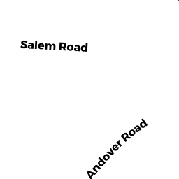
0 ANDOVER RD
Owner Information
BILLERICA CONSERVATION COMM
365 BOSTON RD
BILLERICA, MA 01821


Property Details
0 ANDOVER RD is classified as a Vacant, Conservation (Municipal or County).
0 ANDOVER RD is valued at $274,900. The land is valued at $274,900 and the structures are valued at $0.
The most recent deed for 0 ANDOVER RD is recorded at the local registrar in Book 16684, Page 268. 0 ANDOVER RD was last sold on Tuesday, December 23, 2003 for $1.
Assessment data from fiscal year 2022.
Flood Data
According to the FEMA National Flood Hazard Layer, this property does not appear to be in a flood zone. It may also be in an area not yet reviewed. Nonetheless, confirm this information prior to taking any action.
To view the flood hazards around this property, create a FEMA "Firmette" Map of the area around 0 ANDOVER RD.
Broadband Internet Providers
| Provider | Type | Bandwidth (mbps) | |
|---|---|---|---|
| VSAT Systems, LLC. | Satellite | 2 | 1 |
| Crown Castle Fiber | Fiber | 0 | 0 |
| Verizon New England Inc. | Fiber | 940 | 880 |
| GCI Communication Corp. | Satellite | 0 | 0 |
| HughesNet | Satellite | 25 | 3 |
| Comcast | Cable | 1000 | 35 |
| Viasat Inc | Satellite | 100 | 3 |
Broadband service provider data from December 2020.
Adjacent Properties
- 204 ANDOVER RD
Developable Residential Land owned by MURPHY ROBERT E - 204 ANDOVER RD
Developable Residential Land owned by MURPHY ROBERT E - 0 OLD SALEM RD
Undevelopable Residential Land owned by SWIM LAWRENCE - 0 KITTRIDGE AV
Undevelopable Residential Land owned by ARAKELIAN ALLAN A - 204 ANDOVER RD
Single Family Residential owned by MURPHY ROBERT E